This article needs additional citations for verification. (June 2019) |
Semenanjung Selatan | |
|---|---|
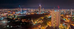
 Makassar, the largest city on the South Peninsula | |
| Geography | |
| Location | Sulawesi |
| Coordinates | 5°S 120°E / 5°S 120°E |
| Adjacent to | Flores Sea Java Sea Gulf of Bone Makassar Strait |
| Highest elevation | 3,478 m (11411 ft) |
| Highest point | Mount Latimojong |
| Administration | |
| Province | |
| Largest settlement | Makassar |
| Demographics | |
| Population | 8.8 million |
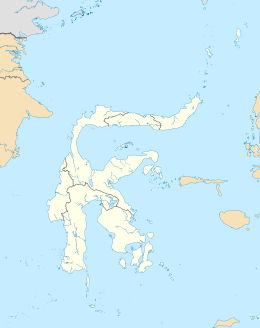
The South Peninsula is one of the four principal peninsulas on the island of Sulawesi, stretching south from the central part of the island. It is part of the province of South Sulawesi. The southern peninsula is the most densely populated peninsula in Sulawesi; over 45% of the population of Sulawesi (or 8.8 million people) are on the southern peninsula. Inhabited by an Austronesian people who came thousands of years ago. The largest ethnic group in Sulawesi is the Bugis, followed by Makassar and Toraja.
Mount Lompobattang lies near the southern tip of this peninsula. and the latimojong mountain is the highest mountain in the southern peninsula of sulawesi and on the island of sulawesi.
