|
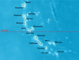
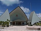
Top: Aerial view of South Tarawa; Middle: Sacred Heart Cathedral, Kiribati Parliament House; Tarawa coastline, Bonriki International Airport | |
 | |
| Geography | |
|---|---|
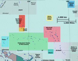
| Location | Pacific Ocean |
| Coordinates | 1°26′N 173°0′E / 1.433°N 173.000°E |
| Archipelago | Gilbert Islands |
| Area | 15.76 km2 (6.08 sq mi) |
| Highest elevation | 3 m (10 ft) |
| Administration | |
Kiribati | |
| Demographics | |
| Population | 63,439[1] (2020 census) |
| Pop. density | 3,578/km2 (9267/sq mi) |
| Ethnic groups | I-Kiribati 95.9% |
South Tarawa (Gilbertese: Tarawa Teinainano) is the capital and hub of the Republic of Kiribati and home to more than half of Kiribati's population.[2] The South Tarawa population centre consists of all the small islets from Betio in the west to Bonriki and Tanaea in the north-east, connected by the South Tarawa main road, with a population of 63,439 as of 2020[update].[1]
South Tarawa is home to most of the government, commercial and education facilities in Kiribati including the Port and the High Court at Betio, the State House, Government Ministries and foreign embassies and High Commissions in Bairiki, the University of the South Pacific campus in Teaoraereke, the House of Assembly in Ambo, the Kiribati Teacher College and King George V and Elaine Bernacchi School, the Government High School, is in Bikenibeu,[3] and the Tungaru central hospital in Nawerewere. The Roman Catholic Diocese is based in Teaoraereke, the Kiribati Uniting Church in Antebuka, the National Spiritual Assembly of the Bahá’ís of Kiribati in Bikenibeu, and the Church of Jesus Christ of Latter-day Saints in Eita.[4]
- ^ a b "Kiribati Census Report 2020 Volume 1" (PDF). National Statistics Office, Ministry of Finance and Economic Development, Government of Kiribati. Archived from the original (PDF) on 30 September 2013. Retrieved 17 August 2020.
- ^ Country files at earth-info.nga.mil Archived 12 August 2005 at the Wayback Machine
- ^ "6. South Tarawa" (PDF). Office of Te Beretitent – Republic of Kiribati Island Report Series. 2012. Retrieved 28 April 2015.
- ^ "South Tarawa Island Report". Government of Kiribati.


