South Wollo
ደቡብ ወሎ | |
|---|---|
 | |
| Country | |
| Region | |
| Largest city | Dessie |
| Area | |
• Total | 17,067.45 km2 (6,589.78 sq mi) |
| Population (2007) | |
• Total | 2,518,862[1] |

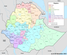
South Wollo (Amharic: ደቡብ ወሎ) is a zone in the Amhara Region of Ethiopia. It acquired its name from the former province of Wollo. South Wollo is bordered on the south by North Shewa and the Oromia Region, on the west by East Gojjam, on the northwest by South Gondar, on the north by North Wollo, on the northeast by Afar Region, and on the east by the Oromia Special Zone and the Argobba special woreda. Its highest point is Mount Tabor in Amhara Sayint, 4247 meter above sea level. Cities in South Wollo include Kombolcha, Hayq, Dessie, Wuchale and Wurgessa.
On 24 August 2009 Zonal authorities announced that approximately 540 safe water units were constructed during the past Ethiopian budget year at a cost of over 23 million birr, while another 878 units were repaired. This has improved the access to safe water from 51% to 61% of the Zone's inhabitants.[2]
- ^ a b Geohive: Ethiopia Archived 2012-08-05 at the Wayback Machine
- ^ "Zone gets 540 safe water units"[permanent dead link], Ethiopian News Agency (accessed 2 November 2009)