Southeast Iowa Regional Airport | |||||||||||||||
|---|---|---|---|---|---|---|---|---|---|---|---|---|---|---|---|
 | |||||||||||||||
| Summary | |||||||||||||||
| Airport type | Public | ||||||||||||||
| Owner | Southeast Iowa Regional Airport Authority | ||||||||||||||
| Serves | Burlington, Iowa | ||||||||||||||
| Elevation AMSL | 698 ft / 213 m | ||||||||||||||
| Coordinates | 40°46′59″N 091°07′32″W / 40.78306°N 91.12556°W | ||||||||||||||
| Website | flybrl.com | ||||||||||||||
| Maps | |||||||||||||||
 FAA airport diagram | |||||||||||||||
 | |||||||||||||||
| Runways | |||||||||||||||
| |||||||||||||||
| Statistics | |||||||||||||||
| |||||||||||||||
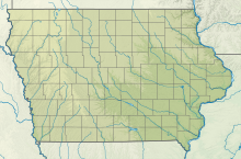
Southeast Iowa Regional Airport (IATA: BRL, ICAO: KBRL, FAA LID: BRL) is a public airport located two miles southwest of Burlington, in Des Moines County, Iowa.[1] It is owned by the Southeast Iowa Regional Airport Authority[1] which includes representatives from the city of Burlington, the city of West Burlington, and Des Moines County. The airport is used for general aviation and sees one airline, a service subsidized by the federal government's Essential Air Service program at a cost of $1,917,566 (per year).[2]
The National Plan of Integrated Airport Systems for 2021–2025 categorized it as a non-primary commercial service airport (between 2,500 and 10,000 enplanements per year).[3]
- ^ a b c FAA Airport Form 5010 for BRL PDF. Federal Aviation Administration. effective December 30, 2021.
- ^ "Essential Air Service Reports". U.S. Department of Transportation. Retrieved June 7, 2014.
- ^ "2011–2015 NPIAS Report, Appendix A" (PDF, 2.03 MB). National Plan of Integrated Airport Systems. Federal Aviation Administration. October 4, 2010.

