| Soutpansberg | |
|---|---|
 The western extremity of the Soutpansberg – as seen from Vivo, 10 km from the salt pan | |
| Highest point | |
| Peak | Lajuma |
| Elevation | 1,747 m (5,732 ft) |
| Listing | Mountain ranges of South Africa |
| Coordinates | 23°0′0″S 29°52′0″E / 23.00000°S 29.86667°E |
| Dimensions | |
| Length | 170 km (110 mi) E/W |
| Width | 50 km (31 mi) N/S |
| Naming | |
| Native name | Tha vhani ya muno (Venda) |
| Geography | |
| Country | South Africa |
| Province | Limpopo |
| Geology | |
| Orogeny | Kaapvaal craton |
| Rock age | Neoarchean to early Paleoproterozoic |
| Rock type(s) | Bushveld igneous complex, sandstone |
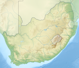
The Soutpansberg (formerly Zoutpansberg), meaning "Salt Pan Mountain" in Afrikaans, is a range of mountains in far northern South Africa. It is located in Vhembe District, Limpopo. It is named for the salt pan (Venda: Thavha ya muno, or "place of salt")[1] located at its western end. The mountain range reaches the opposite extremity[2] in the Matikwa Nature Reserve, some 107 kilometres (66 mi) due east. The range as a whole had no Venda name, as it was instead known by its sub-ranges which include Dzanani, Songozwi and others.[3]
The Soutpansberg forms part of the 'Vhembe Biosphere Reserve', which was designated as a biosphere reserve by UNESCO in 2009.[4] The latter reserve also includes the Blouberg Range, Kruger National Park and the Mapungubwe Cultural Landscape.[5]
- ^ Located at 22°58′S 29°20′E / 22.967°S 29.333°E
- ^ Located at 22°58′S 30°20′E / 22.967°S 30.333°E
- ^ Sacred Traditions and Biodiversity Conservation in the Forest Montane Region of Venda, South Africa. Clark University. 2008. p. 41. ISBN 9780549518686.
{{cite book}}: CS1 maint: location missing publisher (link) - ^ "Vhembe Region named UNESCO's Biosphere Reserve". Archived from the original on 2017-06-20. Retrieved 2012-04-05.
- ^ UNESCO - Biosphere Reserve Information. Accessed 31 July 2023.
