Islas Vírgenes Españolas Islas Vírgenes de Puertorriqueñas | |
|---|---|
 Satellite image, May 2003 | |
| Geography | |
| Coordinates | 18°13′36.27″N 65°20′18.38″W / 18.2267417°N 65.3384389°W |
| Archipelago | Virgin Islands |
| Adjacent to | Caribbean Sea |
| Area | 165.1 km2 (63.7 sq mi) |
| Administration | |
| Municipality | Culebra and Vieques |
| Largest settlement | Isabel II barrio-pueblo (pop. 1,459) |
| Demographics | |
| Population | 11,119 |
| Pop. density | 67.35/km2 (174.44/sq mi) |
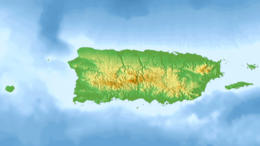
The Spanish Virgin Islands (Spanish: Islas Vírgenes Españolas),[1][2] formerly called the Passage Islands (Spanish: Islas del Pasaje), commonly known as the Puerto Rican Virgin Islands (Spanish: Islas Vírgenes Puertorriqueñas), consist of the islands of Vieques and Culebra, located between the main island of Puerto Rico and the U.S. Virgin Islands in the northeastern Caribbean.[3] Located between the Greater and Lesser Antilles, the islands are administratively part of the archipelago of Puerto Rico, and geographically part of the archipelago of the Virgin Islands of the Leeward Islands in the Lesser Antilles.
Geologically separated from the Greater Antilles island of Hispaniola by the Mona Passage and from the Lesser Antilles island arc by the Anegada Passage, the main island of Puerto Rico, the Spanish Virgin Islands of Vieques and Culebra, the British Virgin Islands, and the U.S. Virgin Islands except for the southernmost island of Saint Croix, all lie on the same carbonate platform and insular shelf, the Puerto Rico Bank, between the North Atlantic Ocean and the Caribbean Sea. The archipelagos of Puerto Rico and the Virgin Islands except for Saint Croix also lie on the same tectonic plate, the Puerto Rico-Virgin Islands Microplate.
- ^ Noticias aliadas (in Spanish). Noticias Aliadas. 2000.
- ^ Américas (in Spanish). Organization of American States, General Secretariat. 2001.
- ^ Howorth, Michael (January 1999). "For the Beauty of It". Yachting. p. 44. Retrieved 2 May 2020.


