Spencer Butte | |
|---|---|
 View of Eugene from Skinner Butte, with Spencer Butte in the distance | |
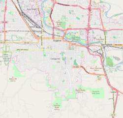
| Coordinates: 43°58′59″N 123°05′45″W / 43.9831°N 123.0957°W | |
| Location | South of Eugene, Oregon, USA |
| Range | Cascade Volcanoes |
| Part of | Little Butte Volcanics[1] |
| Age | approximately 23 to 30 million years |
| Formed by | Intrusion of lava through sandstone base, and subsequent erosion of sandstone |
| Orogeny | Phanerozoic orogen |
| Geology | Butte |
Spencer Butte is a prominent landmark in Lane County, Oregon, United States, described in the National Geodetic Survey as "a prominent timbered butte with a bare rocky summit" on the southern edge of Eugene, with an elevation of 2,058 feet (627 m).[1] Spencer Butte is accessible from Spencer Butte Park and has several hiking trails to the summit.[2] The tree cover on the butte is predominantly Douglas fir; however, the butte is treeless at its summit. The butte is the tallest point visible when looking south from downtown Eugene.
- ^ a b c "Spencer Butte - NGS Data Sheet". U.S. National Geodetic Survey. Retrieved January 20, 2013.
- ^ Sullivan, William (2005). 100 Hikes in the Central Oregon Cascades (3rd ed.). Eugene, Oregon: Navillus Press. pp. 176–177. ISBN 0-9677830-6-2.
