Springdale Municipal Airport | |||||||||||
|---|---|---|---|---|---|---|---|---|---|---|---|
| Summary | |||||||||||
| Airport type | Public | ||||||||||
| Owner | City of Springdale | ||||||||||
| Serves | Springdale, Arkansas | ||||||||||
| Elevation AMSL | 1,353 ft / 412 m | ||||||||||
| Coordinates | 36°10′35″N 094°07′09″W / 36.17639°N 94.11917°W | ||||||||||
| Map | |||||||||||
 | |||||||||||
| Runways | |||||||||||
| |||||||||||
| Statistics (2019) | |||||||||||
| |||||||||||
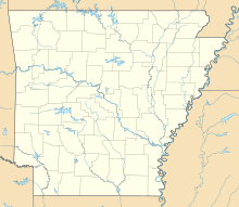
Springdale Municipal Airport (IATA: SPZ, ICAO: KASG, FAA LID: ASG) is a public use airport in Washington County, Arkansas, United States. It is owned by the City of Springdale and located one nautical mile (2 km) southeast of its central business district.[1] This airport is included in the National Plan of Integrated Airport Systems for 2011–2015, which categorized it as a general aviation facility.[2]
Although most U.S. airports use the same three-letter location identifier for the FAA and IATA, this airport is assigned ASG by the FAA[1] and SPZ by the IATA[3] (which assigned ASG to Ashburton Aerodrome in Ashburton, New Zealand).[4] The airport's ICAO identifier is KASG.[5]
- ^ a b c FAA Airport Form 5010 for ASG PDF. Federal Aviation Administration. Effective September 7, 2023.
- ^ "2011–2015 NPIAS Report, Appendix A" (PDF, 2.03 MB). National Plan of Integrated Airport Systems. Federal Aviation Administration. October 4, 2010.
- ^ "Springdale Municipal Airport (ICAO: KASG, FAA: ASG, IATA: SPZ)". Great Circle Mapper. Retrieved July 28, 2012.
- ^ "Ashburton Airport, New Zealand (IATA: ASG, ICAO: NZAS)". Aviation Safety Network. Retrieved July 28, 2012.
- ^ "Springdale Municipal – ASG (KASG)". National Flight Data Center. Federal Aviation Administration. Retrieved July 28, 2012.

