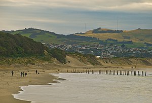
St Clair | |
|---|---|
 St Clair Beach | |
 | |
| Coordinates: 45°54′40″S 170°29′10″E / 45.91111°S 170.48611°E | |
| Country | New Zealand |
| City | Dunedin |
| Established | 1850s |
| Area | |
| • Land | 203 ha (502 acres) |
| Population (June 2024)[2] | |
• Total | 2,470 |
| Corstorphine | Forbury, Kew | South Dunedin |
| St Clair Park |
|
St Kilda |
| Pacific Ocean |


St Clair is a coastal residential suburb of Dunedin, New Zealand.[3] It is located on the Pacific Ocean coast five kilometres from the city centre on the southwesternmost part of the coastal plain which makes up the southern part of the urban area, and also climbs the slopes of Forbury Hill immediately to the west of this plain. According to the New Zealand Census, St Clair's population in 2018 was 2,346.
- ^ Cite error: The named reference
Areawas invoked but never defined (see the help page). - ^ "Aotearoa Data Explorer". Statistics New Zealand. Retrieved 26 October 2024.
- ^ "Place name detail: St Clair". New Zealand Gazetteer. New Zealand Geographic Board. Retrieved 6 March 2009.