Stadsbygd Municipality
Stadsbygd herred | |
|---|---|
| Stadsbygden herred (historic name) | |
 | |
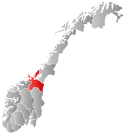
 Sør-Trøndelag within Norway | |
 Stadsbygd within Sør-Trøndelag | |
| Coordinates: 63°30′34″N 10°01′09″E / 63.50944°N 10.01917°E | |
| Country | Norway |
| County | Sør-Trøndelag |
| District | Fosen |
| Established | 1 Jan 1838 |
| • Created as | Formannskapsdistrikt |
| Disestablished | 1 Jan 1964 |
| • Succeeded by | Rissa and Agdenes |
| Administrative centre | Stadsbygd |
| Area (upon dissolution) | |
| • Total | 137 km2 (53 sq mi) |
| Population (1964) | |
| • Total | 1,787 |
| • Density | 13/km2 (34/sq mi) |
| Demonym | Stadværing[1] |
| Time zone | UTC+01:00 (CET) |
| • Summer (DST) | UTC+02:00 (CEST) |
| ISO 3166 code | NO-1625[2] |
Stadsbygd is a former municipality in the old Sør-Trøndelag county, Norway. The municipality existed from 1838 until its dissolution in 1964. The 137-square-kilometre (53 sq mi) municipality existed on the southern part of the Fosen peninsula, along the Trondheimsfjorden in what is now the municipality of Indre Fosen in Trøndelag county. The administrative centre was the village of Stadsbygd, just north of the Stadsbygd Church.[3]
- ^ "Navn på steder og personer: Innbyggjarnamn" (in Norwegian). Språkrådet.
- ^ Bolstad, Erik; Thorsnæs, Geir, eds. (26 January 2023). "Kommunenummer". Store norske leksikon (in Norwegian). Kunnskapsforlaget.
- ^ Rosvold, Knut A., ed. (4 January 2018). "Stadsbygd". Store norske leksikon (in Norwegian). Kunnskapsforlaget. Retrieved 4 March 2018.