| Stalmine-with-Staynall | |
|---|---|
 On the bank of the River Wyre | |
Location within Lancashire | |
| Area | 9.8568 km2 (3.8057 sq mi) |
| Population | 1,486 (2011)[1] |
| • Density | 151/km2 (390/sq mi) |
| OS grid reference | SD371456 |
| Civil parish |
|
| District | |
| Shire county | |
| Region | |
| Country | England |
| Sovereign state | United Kingdom |
| Post town | POULTON-LE-FYLDE |
| Postcode district | FY6 |
| Dialling code | 01253 |
| Police | Lancashire |
| Fire | Lancashire |
| Ambulance | North West |
| UK Parliament | |
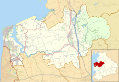
Stalmine-with-Staynall is a civil parish within the Wyre borough of Lancashire, England, in a part of the Fylde known as Over Wyre. The parish contains the village of Stalmine and the hamlets of Staynall and Wardleys.[2] The civil parish had a population of 1,486 at the 2011 Census,[1] of which 1,087 lived in Stalmine village.[3]
Located close to the Irish Sea coast, the Wyre Estuary forms the parish's western boundary. The highest point is only approximately 75 feet (23 m) above sea level.[2] The parish adjoins the Wyre parishes of Fleetwood, Preesall, Pilling, Out Rawcliffe, Hambleton and the Thornton area which is unparished.
- ^ a b UK Census (2011). "Local Area Report – Stalmine-with-Staynall Parish (E04005337)". Nomis. Office for National Statistics. Retrieved 29 December 2021.
- ^ a b Farrer, William; Brownbill, J. (1912). "The parish of Lancaster: Stalmine with Staynall". A History of the County of Lancaster. Victoria County History. 7. London: Constable: 21–256. OCLC 59626695. Retrieved 29 December 2021.
- ^ UK Census (2011). "Local Area Report – Stalmine Built-up area (E34001164)". Nomis. Office for National Statistics. Retrieved 29 December 2021.


