Standerton | |
|---|---|
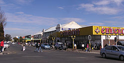
 Central business district in Standerton. | |
| Coordinates: 26°57′S 29°15′E / 26.950°S 29.250°E | |
| Country | South Africa |
| Province | Mpumalanga |
| District | Gert Sibande |
| Municipality | Lekwa |
| Established | 14 December 1878 |
| Area | |
| • Total | 45.96 km2 (17.75 sq mi) |
| Elevation | 1,530 m (5,020 ft) |
| Population (2011)[1] | |
| • Total | 84,383 |
| • Density | 1,800/km2 (4,800/sq mi) |
| Racial makeup (2011) | |
| • Black African | 39.3% |
| • White | 35.0% |
| • Coloured | 15.4% |
| • Indian/Asian | 9.1% |
| • Other | 1.2% |
| First languages (2011) | |
| • Afrikaans | 50.3% |
| • Zulu | 21.2% |
| • English | 17.4% |
| • Sotho | 3.5% |
| • Other | 7.6% |
| Time zone | UTC+2 (SAST) |
| Postal code (street) | 2430 |
| PO box | 2430 |
| Area code | 017 |
Standerton is a large commercial and agricultural town lying on the banks of the Vaal River in Mpumalanga, South Africa, which specialises in cattle, dairy, maize and poultry farming. The town was established in 1876 and named after Boer leader Commandant A. H. Stander. During the First Boer War a British garrison in the town was besieged by the Boers for three months. General Jan Smuts won this seat during elections and went on to assist in setting up the League of Nations. Standerton is the seat of the Lekwa Local Municipality.[2]
- ^ a b c d "Sub Place Standerton". Census 2011.
- ^ "LEKWA MUNICIPALITY in Standerton South Africa".

