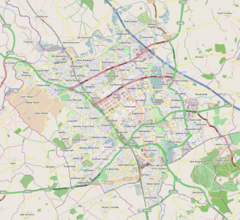
| Stantonbury | |
|---|---|
 St Peter's Church, Stanton Low | |
Location within Buckinghamshire | |
| Population | 10,084 (2011 Census)[1] |
| OS grid reference | SP847414 |
| Civil parish |
|
| Unitary authority | |
| Ceremonial county | |
| Region | |
| Country | England |
| Sovereign state | United Kingdom |
| Post town | MILTON KEYNES |
| Postcode district | MK14 |
| Dialling code | 01908 |
| Police | Thames Valley |
| Fire | Buckinghamshire |
| Ambulance | South Central |
| UK Parliament | |
Stantonbury is a district and civil parish of Milton Keynes, Buckinghamshire, England, situated roughly 2 miles (3.2 km) north of Central Milton Keynes.[2] The toponym Stanton is derived from an Old English term for "stone-built farmstead" and the bury element from the French family Barri who held it in 1235.[3][4] The original Stantonbury is a deserted medieval village now known as Stanton Low;[5] the Stantonbury name has been reused for the modern district at the heart of the civil parish.
- ^ UK Census (2011). "Local Area Report – Stantonbury (E04012191)". Nomis. Office for National Statistics. Retrieved 17 November 2019.
- ^ "Parishes Boundaries as at 2012" (PDF). Milton Keynes Council. 2012.
- ^ "Key to English place names: Stantonbury". Institute for Name-Studies, University of Nottingham. Archived from the original on 28 March 2022. Retrieved 28 March 2022.
- ^ "Plea Rolls of the Court of Common Pleas; National Archives; CP40/654". 1424. "Stanton Barry".
- ^ Mynard (1971).


