| Staple Fitzpaine | |
|---|---|
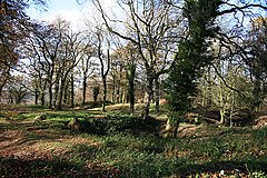
 Castle Neroche | |
 Staple Fitzpaine manor house | |
Location within Somerset | |
| Population | 189 (2011)[1] |
| OS grid reference | ST262183 |
| Unitary authority | |
| Ceremonial county | |
| Region | |
| Country | England |
| Sovereign state | United Kingdom |
| Post town | TAUNTON |
| Postcode district | TA3 |
| Dialling code | 01823 |
| Police | Avon and Somerset |
| Fire | Devon and Somerset |
| Ambulance | South Western |
| UK Parliament | |
Staple Fitzpaine is a village and civil parish in Somerset, England, situated 5 miles (8.0 km) south of Taunton. The village has a population of 189[1] and is within the Blackdown Hills Area of Outstanding Natural Beauty. The parish includes the hamlet of Badger Street.
The parish (by area the second-largest in Somerset) stretches south to Castle Neroche, east to Whitty Cross, west to Staple Hill and north to just past Smokey Bottom. The main part of the village is centred on the crossroads by the Greyhound Inn,[2] on the Taunton-Chard road. Curland and Bickenhall, two smaller villages close by to the east, are socially and culturally one with Staple Fitzpaine. They have a combined population of almost 200.
- ^ a b "Statistics for Wards, LSOAs and Parishes — SUMMARY Profiles" (Excel). Somerset Intelligence. Retrieved 4 January 2014.
- ^ Historic England. "Greyhound Inn (1060278)". National Heritage List for England. Retrieved 29 September 2007.
