This article needs additional citations for verification. (January 2024) |
| Steinhuder Meer | |
|---|---|
 Wilhelmstein fortress in the lake | |
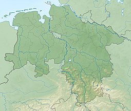
| Location | 30 km NW of Hanover, Lower Saxony |
| Coordinates | 52°28′N 9°20′E / 52.467°N 9.333°E |
| Primary inflows | groundwater, precipitation |
| Primary outflows | Steinhuder Meerbach (towards Weser) |
| Basin countries | Germany |
| Max. length | 8 km (5.0 mi) |
| Max. width | 4.5 km (2.8 mi) |
| Surface area | 29.12 km2 (11.24 sq mi) |
| Average depth | 1.35 m (4 ft 5 in) |
| Max. depth | 3 m (9.8 ft) |
| Water volume | 0.088 km3 (0.021 cu mi) |
| Surface elevation | 38 m (125 ft) |
| Islands | 2 (Wilhelmstein and Badeinsel) |
| Settlements | Steinhude,Hagenburg, Mardorf |
| Designated | 26 February 1976 |
| Reference no. | 87[1] |
Lake Steinhude, German: Steinhuder Meer, ,[2] is a lake in Lower Saxony, Germany located 30 kilometres (19 mi) northwest of Hanover. Named after the nearby village of Steinhude, it has an area of about 30 square kilometres (12 sq mi), making it the largest lake of northwestern Germany. At the same time, Lake Steinhude is very shallow, with an average depth of only 1.35 metres (4.4 ft) and a maximum depth of less than 3 metres (9.8 ft). It lies within a region known as the Hanoverian Moor Geest.
- ^ "Steinhuder Meer". Ramsar Sites Information Service. Retrieved 25 April 2018.
- ^ "Lake Steinhude". www.germany-tourism.co.uk. Retrieved 21 March 2011.[dead link]
