| William C. Sterling State Park | |
|---|---|
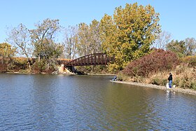
 Pedestrian bridge over lagoon | |
| Location | Frenchtown Charter Township Monroe County, Michigan |
| Nearest city | Monroe, Michigan |
| Coordinates | 41°54′56″N 83°20′01″W / 41.91556°N 83.33361°W[2] |
| Area | 1,300 acres (530 ha) |
| Elevation | 591 feet (180 m)[2] |
| Designation | Michigan state park |
| Established | 1935[3] |
| Administrator | Michigan Department of Natural Resources |
| Website | Sterling State Park |

William C. Sterling State Park is a public recreation area located in Frenchtown Charter Township with a small portion lying within the city limits of Monroe, Michigan. It is the only Michigan state park located on Lake Erie. The park encompasses 1,300 acres (530 ha) of mostly man-made lagoons and beachfront near the mouth of Sandy Creek. The main attractions at the park include a 256-site campground, beach area, boat launch, and shore fishing lagoons. There are over seven miles (11 km) of biking and hiking trails within the park.[4]
- ^ "Sterling State Park". IUCN. Retrieved April 22, 2020.
- ^ a b "Sterling State Park". Geographic Names Information System. United States Geological Survey, United States Department of the Interior.
- ^ Cite error: The named reference
mdnr3was invoked but never defined (see the help page). - ^ Cite error: The named reference
mdnrwas invoked but never defined (see the help page).

