This article needs additional citations for verification. (February 2018) |
Stewart | |
|---|---|
| District of Stewart[1] | |
 | |
| Coordinates: 55°56′09″N 129°59′27″W / 55.93583°N 129.99083°W | |
| Country | Canada |
| Province | British Columbia |
| Regional district | Kitimat–Stikine |
| Incorporated | 1930 |
| Government | |
| • Mayor | Angela Brand Danuser |
| Area | |
| • Total | 552.08 km2 (213.16 sq mi) |
| Elevation | 0 m (0 ft) |
| Population (2016) | |
| • Total | 401 |
| • Density | 0.73/km2 (1.9/sq mi) |
| Time zone | UTC−8 (PST) |
| Postal Code 0098 | V0T 1W0 |
| Area code(s) | 250, 778, 236 |
| Highways | |
| Website | districtofstewart |
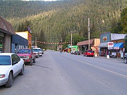
Stewart is a district municipality at the head of the Portland Canal in northwestern British Columbia, Canada,[2] near the Alaskan panhandle. In 2021, it had a population of 517.

- ^ "British Columbia Regional Districts, Municipalities, Corporate Name, Date of Incorporation and Postal Address" (XLS). British Columbia Ministry of Communities, Sport and Cultural Development. Retrieved 2 November 2014.
- ^ "Stewart (district municipality)". BC Geographical Names.
