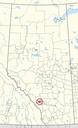
Stoney 142, 143, 144 | |
|---|---|
| Stoney Indian Reserve Nos. 142, 143, and 144 | |
 Boundaries of Stoney 142, 143, 144 | |
 Location in Alberta | |
| First Nations | Stoney Nakoda |
| Treaty | 7 |
| Country | Canada |
| Province | Alberta |
| Municipal districts | Bighorn No. 8 Rocky View County |
| Area | |
| • Total | 39,264.5 ha (97,024.7 acres) |
| Population (2016)[2] | |
| • Total | 3,713 |
| • Density | 9.5/km2 (24/sq mi) |
Stoney 142, 143, 144 is an Indian reserve of the Stoney Nakoda First Nation, comprising Bearspaw, Chiniki, and Wesley First Nations in Alberta, located between the Municipal District of Bighorn No. 8 and Rocky View County.[3] The largest community of the Nakoda people, it is 56 kilometers west of Calgary.[1]
The community is spread along both sides of the Trans-Canada Highway, east of Banff National Park and north of Kananaskis Improvement District. In addition to Kananaskis, it is also bordered by Bighorn No. 8, Rocky View County, and the town of Cochrane. By land area, it is the third-largest Indian reserve in Canada (after Blood 148 and Siksika 146, both also in Alberta).
According to the Canada 2011 Census:
- Population: 3,494
- % Change (1996–2001): 0.7
- % Change (2001–2011): 38.16
- Dwellings: 795
- Area (km2): 444.94
- Density (persons per km2): 7.85
- ^ a b "Reserve/Settlement/Village Detail". Crown–Indigenous Relations and Northern Affairs Canada. Government of Canada. Retrieved August 12, 2019.
- ^ "Census Profile, 2016 Census". Statistics Canada. February 8, 2017. Retrieved 2019-08-10.
- ^ Government of Alberta (May 25, 2019). Municipal Boundaries (Map). AltaLIS.