| State Highway 4 | ||||
|---|---|---|---|---|
| Strada statale 4 | ||||
| Salaria | ||||
 | ||||
| Route information | ||||
| Maintained by ANAS | ||||
| Length | 208.2 km (129.4 mi) reduced to 175 km since the Ascoli-Porto d'Ascoli trait was declassed to provincial road | |||
| Existed | 1928–present | |||
| Major junctions | ||||
| From | City centre of Rome | |||
| Tangenziale Est and GRA in Rome; Autostrada A1 at Settebagni; SS 313 in Passo Corese; SS 636 di Palombara at Borgo Quinzio; SS 79 Ternana and SS 578 Salto Cicolana in Rieti; SS 17 in Antrodoco; SS 471 di Leonessa at Posta; SS 260 Picente at Amatrice; SS 685 delle Tre Valli Umbre at Arquata del Tronto; Raccordo autostradale 11 and SS 81 Piceno Aprutina at Ascoli Piceno | ||||
| To | SS 16 Adriatica at Porto d'Ascoli | |||
| Location | ||||
| Country | Italy | |||
| Regions | Lazio, Marche | |||
| Highway system | ||||
| ||||
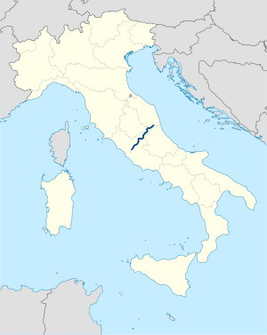
Strada statale 4 Via Salaria (SS 4) is an Italian state highway 208.2 kilometres (129.4 mi) long in Italy located in the regions of Lazio and Marche, linking Rome to the Adriatic Sea passing through Rieti and Ascoli Piceno. Its route retraces that of the ancient Via Salaria Roman road. It is a single carriageway highway for most of its route.
