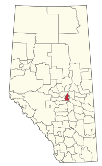
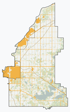
Strathcona County | |
|---|---|
 Location within Alberta | |
| Coordinates: 53°31′24″N 113°18′32″W / 53.52333°N 113.30889°W | |
| Country | Canada |
| Province | Alberta |
| Region | Edmonton Metropolitan Region |
| Census division | No. 11 |
| - Municipal district | 1943 |
| - Specialized municipality | January 1, 1996 |
| Named for | Donald Smith, 1st Baron Strathcona and Mount Royal |
| Government | |
| • Mayor | Rod Frank |
| • Governing body | Strathcona County Council
|
| • Seat | Sherwood Park |
| Area (2021)[4] | |
| • Land | 1,170.65 km2 (451.99 sq mi) |
| Population (2021)[4] | |
• Total | 99,225 |
| • Density | 84.8/km2 (220/sq mi) |
| • Municipal census (2024) | 103,829[5] |
| Time zone | UTC-7 (MST) |
| • Summer (DST) | UTC-6 (MDT) |
| Website | strathcona.ca |
Strathcona County is a specialized municipality in the Edmonton Metropolitan Region within Alberta, Canada between Edmonton and Elk Island National Park. It forms part of Census Division No. 11.
Strathcona County is both urban and rural in nature. Approximately 73% of its population lives in Sherwood Park, which is an urban service area east of Edmonton, remains an unincorporated hamlet. The balance lives beyond Sherwood Park within a rural service area.
- ^ Strathcona County (2010-04-27). "Local Government History". Strathcona County. Retrieved 2010-10-02.
- ^ Alberta Municipal Affairs (2010-09-17). "Municipal Profile – Strathcona County". Retrieved 2010-10-02.
- ^ "Municipal Officials Search". Alberta Municipal Affairs. May 9, 2019. Retrieved October 1, 2021.
- ^ a b Cite error: The named reference
2021censuswas invoked but never defined (see the help page). - ^ Cite error: The named reference
2024censuswas invoked but never defined (see the help page).
