| Stubai Alps | |
|---|---|
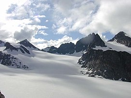
 Lisenser FernerKogel, Rotgratspitze and Lisenser Spitze in July | |
| Highest point | |
| Peak | Zuckerhütl |
| Elevation | 3,507 m (11,506 ft) |
| Coordinates | 46°57′42″N 11°9′13″E / 46.96167°N 11.15361°E |
| Geography | |
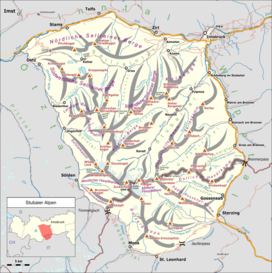
 Location of the Stubai Alps. The borders of the range according to Alpine Club classification of the Eastern Alps | |
| Countries |
|
| States | |
| Range coordinates | 47°05′N 11°10′E / 47.083°N 11.167°E |
| Parent range | Central Eastern Alps |
The Stubai Alps (in German Stubaier Alpen) is a mountain range in the Central Eastern Alps of Europe. It derives its name from the Stubaital valley to its east and is located southwest of Innsbruck, Austria. Several peaks form the border between Austria and Italy. The range is bounded by the Inn River valley to the north; the Sill River valley (Wipptal) and the Brenner Pass to the east (separating it from the Zillertal Alps); the Ötztal and Timmelsjoch to the west (separating it from the Ötztal Alps), and to the south by tributaries of the Passer River and Eisack.