This article needs additional citations for verification. (November 2016) |
Sungai Buloh | |
|---|---|
| Other transcription(s) | |
| • Jawi | سوڠاي بولوه |
| • Chinese | 双溪毛糯 (Simplified) 雙溪毛糯 (Traditional) |
| • Tamil | சுங்கை பூலோ |
 Jalan Kuala Selangor in Sungai Buloh, from Entrance B of Sungai Buloh Station | |
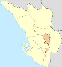
Location in Selangor Location in Peninsular Malaysia | |
| Coordinates: 3°12′36″N 101°32′59″E / 3.21000°N 101.54972°E | |
| Country | Malaysia |
| State | Selangor |
| District | Petaling Gombak Kuala Selangor |
| Establishment | Unclear, 19th century. |
| Time zone | UTC+8 (MST) |
| Postcode | 40160, 47000 |
| Area codes | +603-60, +603-614, +603-615 |
Sungai Buloh, or Sungei Buloh, is a town, a mukim (commune) and a parliamentary constituency in the northern part of Petaling District, Selangor, Malaysia. The name itself means bamboo river in the Malay language. It is located 16 km NW of downtown Kuala Lumpur and 8 km north of the Subang Airport, along the Kuala Selangor highway.
Bordering Damansara, Kepong, Kuang and Kuala Selangor, Sungai Buloh is notable for its colonial-era leper colony, one of the largest in the country.


