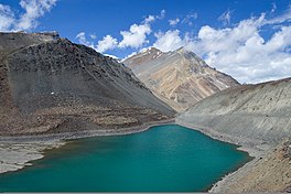
| Suraj Tal Surya Tal | |
|---|---|
 | |
| Location | CB Range, Lahaul Valley, Himachal |
| Coordinates | 32°45′46″N 77°23′52″E / 32.76278°N 77.39778°E |
| Type | High altitude Lake |
| Primary inflows | Glacier and Snow melt |
| Primary outflows | Bhaga River |
| Basin countries | India |
| Shore length1 | 4 km (2.5 mi) |
| Surface elevation | 4,883 m (16,020.3 ft) |
| Frozen | During winter |
| 1 Shore length is not a well-defined measure. | |
Suraj Tal, also called Tso Kamtsi or Surya Tal, is an 800 m (2,600 ft) long lake that lies just below the 4,890 m (16,040 ft) high Bara-lacha-la pass in Lahaul and Spiti district of the Indian state of Himachal Pradesh. It is the third-highest lake in India and the 21st-highest in the world.[1][2] Suraj Tal Lake is just below the source of the Bhaga River that joins the Chandra River downstream at Tandi to form the Chandrabhaga River in Himachal Pradesh. The Chandrabhaga River is known as the Chenab as it enters the Jammu region of Jammu and Kashmir.[2] The other major tributary of the Chandrabhaga, the Chandra, originates and flows south-east of the Bara-lacha La.[3]
