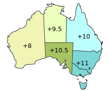


Surveyor Generals Corner (or Surveyor-Generals Corner) is the point where the Australian state boundaries of South Australia, Western Australia and the Northern Territory meet.[1][2]
These boundaries meet at the easternmost point of the approximately 127-metre-long (417 ft) section of the Western Australian border with the Northern Territory border which runs east–west along the 26th parallel south latitude to meet the western boundary of the South Australian border.[1]
- ^ a b Porter, John R. (31 March – 6 April 1990). Longitude 129 degrees east, and why it is not the longest, straight line in the world (PDF). 32nd Australian Surveyors Congress. Canberra: Institution of Surveyors Australia. pp. 18–24. OCLC 220695231. Archived (PDF) from the original on 9 January 2022. Retrieved 15 September 2022.
- ^ Australia Road and 4WD Atlas (Map). Eight Mile Plains Queensland: Hema Maps. 2007. p. 74. ISBN 978-1-86500-456-3.