Svay Chek
ស្រុកស្វាយចេក | |
|---|---|
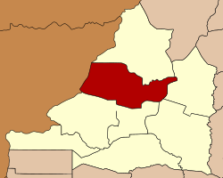
 Map showing the location of the district within Banteay Meanchey Province. | |
| Coordinates: 13°40′N 103°0′E / 13.667°N 103.000°E | |
| Country | |
| Province | Banteay Meanchey |
| Communes | 8 |
| Villages | 63 |
| Government | |
| • អភិបាល | លឿង សុភក្តិ |
| Population (2008) | |
| • Total | 55,596 |
| Time zone | +7 |
| Geocode | 0108 |
Svay Chek (Khmer: ស្រុកស្វាយចេក, lit. 'The Purple Banana') is a district (srok) in the north of Banteay Meanchey province, in north-western Cambodia. The district capital is Svay Chek town located around 22 kilometres north of the provincial capital of Sisophon by road. The district shares a border with Thailand to the west. No national highway runs through the district but national road 56 from Sisophon to Samraong in Oddar Meanchey province crosses the district from north to south.[1]
The district is easily accessed by road from Sisophon (22 km) Battambang (city) (90 km) and Siem Reap (city) (124 km). Svay Chek district is one of the smaller districts in Banteay Meanchey province and also has the smallest population after Malai and Phnom Srok. The western half of the district towards Thailand is largely unpopulated. There are no official border crossings in the district but one provincial road begins near Phnom Srok and crosses the district to end at the Thai border. Numerous smaller roads also run to the Thai border in the western half of the district.[2]
