Sveio Municipality
Sveio kommune | |
|---|---|
| Sveen herred (historic name) | |
 View of the Ryvarden coastline in Sveio | |
|
| |
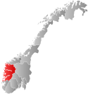
 Vestland within Norway | |
 Sveio within Vestland | |
| Coordinates: 59°34′25″N 05°21′48″E / 59.57361°N 5.36333°E | |
| Country | Norway |
| County | Vestland |
| District | Haugalandet |
| Established | 1865 |
| • Preceded by | Fjelberg and Finnås |
| Administrative centre | Sveio |
| Government | |
| • Mayor (2023) | André Mundal Haukås (H) |
| Area | |
| • Total | 246.14 km2 (95.04 sq mi) |
| • Land | 224.26 km2 (86.59 sq mi) |
| • Water | 21.88 km2 (8.45 sq mi) 8.9% |
| • Rank | #290 in Norway |
| Population (2023) | |
| • Total | 5,732 |
| • Rank | #165 in Norway |
| • Density | 25.6/km2 (66/sq mi) |
| • Change (10 years) | |
| Demonym | Sveibu[1] |
| Official language | |
| • Norwegian form | Nynorsk |
| Time zone | UTC+01:00 (CET) |
| • Summer (DST) | UTC+02:00 (CEST) |
| ISO 3166 code | NO-4612[3] |
| Website | Official website |
Sveio is a municipality in Vestland county, Norway. Sveio is a border district that is sometimes considered to be located in the traditional district of Haugalandet since it is located on the Haugalandet peninsula, but it is also considered to be in the traditional district of Sunnhordland since it is located in southern Hordaland county.[4][5] The administrative centre of the municipality is the village of Sveio. Other villages in the municipality include Auklandshamn, Førde, Våga, and Valevåg.
The 246-square-kilometre (95 sq mi) municipality is the 290th largest by area out of the 356 municipalities in Norway. Sveio is the 165th most populous municipality in Norway with a population of 5,732. The municipality's population density is 25.6 inhabitants per square kilometre (66/sq mi) and its population has increased by 6.1% over the previous 10-year period.[6][7]
Sveio is the site of the Ryvarden Lighthouse which marks the western entrance to the Hardangerfjorden. The lighthouse is automated and the old keepers house and building have now been converted into art galleries, the Flókemuseum, and a cafe.[8] The composer Fartein Valen lived much of his life in Valevåg in northern Sveio. Valenheimen, the house he lived in is open to the public and the Fartein Valen Festival is held annually in Sveio.
The Triangle Link bridge-tunnel network is based in northern Sveio, connecting the islands to the north to the mainland. The southern entrance to the Bømlafjord Tunnel is located along the European route E39 highway, just south of the village of Valevåg.
- ^ "Navn på steder og personer: Innbyggjarnamn" (in Norwegian). Språkrådet.
- ^ "Forskrift om målvedtak i kommunar og fylkeskommunar" (in Norwegian). Lovdata.no.
- ^ Bolstad, Erik; Thorsnæs, Geir, eds. (26 January 2023). "Kommunenummer". Store norske leksikon (in Norwegian). Kunnskapsforlaget.
- ^ Store norske leksikon. "Sunnhordland – område" (in Norwegian). Retrieved 11 March 2015.
- ^ Store norske leksikon. "Sveio" (in Norwegian). Retrieved 11 March 2015.
- ^ Statistisk sentralbyrå. "Table: 06913: Population 1 January and population changes during the calendar year (M)" (in Norwegian).
- ^ Statistisk sentralbyrå. "09280: Area of land and fresh water (km²) (M)" (in Norwegian).
- ^ "Ryvarden Lighthouse". Samarbeidsrådet for Sunnhordland.

