Native name: Sverdrup Ø | |
|---|---|
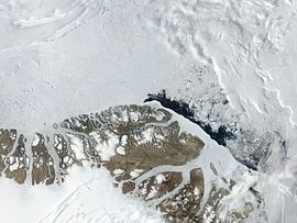
 Satellite image of the northern end of Greenland with Sverdrup Island in centre left. | |
 Map of Sverdrup Island | |
| Geography | |
| Location | Lincoln Sea |
| Coordinates | 82°54′N 46°36′W / 82.900°N 46.600°W |
| Adjacent to | Arctic Ocean |
| Area | 436 km2 (168 sq mi) |
| Area rank | 20th largest in Greenland |
| Length | 28 km (17.4 mi) |
| Width | 20 km (12 mi) |
| Coastline | 130 km (81 mi) |
| Highest elevation | 1,317 m (4321 ft) |
| Administration | |
| Municipality | Northeast Greenland National Park |
| Demographics | |
| Population | 0 (2022) |
| Pop. density | 0/km2 (0/sq mi) |
| Ethnic groups | Inuit |
Sverdrup Island (Danish: Sverdrup Ø) is an uninhabited island in the far north of Greenland, in the Northeast Greenland National Park area. It is named after Otto Sverdrup.
