| Swallow Falls State Park | |
|---|---|
 Muddy Creek Falls | |
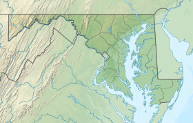
| Location | Garrett County, Maryland, United States |
| Nearest town | Oakland, Maryland |
| Coordinates | 39°29′48″N 79°25′31″W / 39.49667°N 79.42528°W[2] |
| Area | 257 acres (104 ha)[3] |
| Elevation | 2,382 ft (726 m)[2] |
| Designation | Maryland state park |
| Established | 1930s |
| Administrator | Maryland Department of Natural Resources |
| Website | Swallow Falls State Park |

Swallow Falls State Park is a public recreation area located on the west bank of the Youghiogheny River nine miles (14 km) northwest of Oakland in Garrett County, Maryland, in the United States. The state park features Maryland's highest free-falling waterfall, the 53-foot (16 m) Muddy Creek Falls,[4] as well as smaller waterfalls on the Youghiogheny River and Tolivar Creek.[5] The park is notable for its stand of old hemlock trees,[6] some more than 300 years old, "the last stand of its kind in Maryland."[7]
- ^ "Swallow Falls State Park". Protected Planet. IUCN. Retrieved May 1, 2018.
- ^ a b "Swallow Falls State Park". Geographic Names Information System. United States Geological Survey, United States Department of the Interior.
- ^ Cite error: The named reference
acreagereportwas invoked but never defined (see the help page). - ^ Cite error: The named reference
mgswas invoked but never defined (see the help page). - ^ Cite error: The named reference
mdnrwas invoked but never defined (see the help page). - ^ Cite error: The named reference
consfundwas invoked but never defined (see the help page). - ^ Cite error: The named reference
histmarkerwas invoked but never defined (see the help page).
