Syracuse, Utah | |
|---|---|
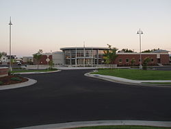
 Syracuse City Municipal Center | |
 Location in Davis County and the state of Utah | |
| Coordinates: 41°05′09″N 112°04′11″W / 41.08583°N 112.06972°W | |
| Country | United States |
| State | Utah |
| County | Davis |
| Settled | 1878 |
| Incorporated | September 3, 1935 |
| City | September 13, 1950 |
| Named for | Syracuse, New York |
| Government | |
| • Type | Mayor-council government |
| Area | |
| • Total | 10.18 sq mi (26.37 km2) |
| • Land | 10.18 sq mi (26.35 km2) |
| • Water | 0.01 sq mi (0.02 km2) |
| Elevation | 4,272 ft (1,302 m) |
| Population | |
| • Total | 24,331 |
| • Density | 3,091.39/sq mi (1,193.63/km2) |
| Time zone | UTC-7 (Mountain (MST)) |
| • Summer (DST) | UTC-6 (MDT) |
| ZIP code | 84075 |
| Area codes | 385, 801 |
| FIPS code | 49-74810 |
| GNIS feature ID | 2412024[2] |
| Website | www |
Syracuse is a city in Davis County, Utah, United States. It is situated between the Great Salt Lake and Interstate 15, about 30 miles (48 km) north of Salt Lake City. It is part of the Ogden–Clearfield Metropolitan Statistical Area. The city has seen rapid growth and development since the 1990s. The city population was 24,331 at the time of the 2010 census,[3] an increase of 158.9% since the 2000 census.
While settlers have populated the area since the mid-1800s, Syracuse was incorporated on September 3, 1935. The city was named by early settlers for Syracuse, New York, which was famed for its salt production in the 19th century.[4]
- ^ "2019 U.S. Gazetteer Files". United States Census Bureau. Retrieved August 7, 2020.
- ^ a b U.S. Geological Survey Geographic Names Information System: Syracuse, Utah
- ^ a b "Geographic Identifiers: 2010 Demographic Profile Data (G001): Syracuse city, Utah". American Factfinder. U.S. Census Bureau. Archived from the original on February 13, 2020. Retrieved January 11, 2016.
- ^ "Syracuse History | Syracuse, UT".