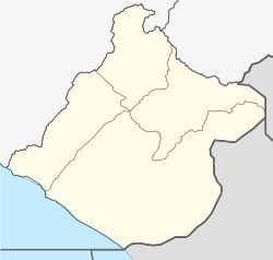
Tacna
Takana San Pedro de Tacna | |
|---|---|
 Clockwise from top: Alto de la Alianza, the Coliseo Cerrado Perú, Municipal Hall, Basadre Stadium, Cathedral and railway museum | |
| Nickname(s): La Ciudad Heroica (The Heroic City) | |
| Coordinates: 18°03′20″S 70°14′54″W / 18.05556°S 70.24833°W | |
| Country | |
| Region | Tacna |
| Province | Tacna |
| District | Tacna |
| Established | 29 June 1541 |
| Government | |
| • Mayor | Julio Daniel Medina Castro (2019–2022) |
| Area | |
| • Total | 14,766.63 km2 (5,701.43 sq mi) |
| Elevation | 552 m (1,811 ft) |
| Population (2017) | |
| • Total | 286,240 |
| • Estimate (2015)[1] | 293,116 |
| • Density | 19/km2 (50/sq mi) |
| Demonym | Tacneño/a |
| Time zone | UTC-5 (PET) |
| UBIGEO | 23000 |
| Area code | 52 |
| Website | munitacna.gob.pe |
Tacna, officially known as San Pedro de Tacna,[2][3] is a city in southern Peru and the regional capital of the Tacna Region. A very commercially active city, it is located only 35 km (22 mi) north of the border with Arica y Parinacota Region from Chile, inland from the Pacific Ocean and in the valley of the Caplina River. It is Peru's tenth most populous city.
The city has gained a reputation for its patriotism, with many monuments and streets named after heroes of Peru's struggle for independence (1821–1824) and the War of the Pacific (1879–1883). Residents of Tacna are known in Spanish as tacneños.
- ^ Perú: Población estimada al 30 de junio y tasa de crecimiento de las ciudades capitales, por departamento, 2011 y 2015. Perú: Estimaciones y proyecciones de población total por sexo de las principales ciudades, 2012–2015 (Report). Instituto Nacional de Estadística e Informática. March 2012. Retrieved 3 June 2015.
- ^ "Historia". Municipalidad Provincial de Tacna.
- ^ Moreno, Kevin (28 August 2023). "Aniversario de Tacna 2023: ¿Qué significa Tacna y por qué se le llama 'Ciudad HeroIca?". La República.


