Taihape | |
|---|---|
 | |
 | |
| Coordinates: 39°40.6′S 175°47.8′E / 39.6767°S 175.7967°E | |
| Country | New Zealand |
| Region | Manawatū-Whanganui |
| District | Rangitikei District |
| Wards |
|
| Community | Taihape Community |
| Early settlement | pre-European |
| Taihape | 1894 |
| Named for | Shortened form of Ōtaihape. |
| Electorates | |
| Government | |
| • Territorial Authority | Rangitikei District Council |
| • Regional council | Horizons Regional Council |
| Area | |
| • Total | 4.93 km2 (1.90 sq mi) |
| Population (June 2024)[2] | |
| • Total | 1,810 |
| • Density | 370/km2 (950/sq mi) |
| Postcode | 4720 |
| Area code | 06 |

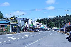
Taihape is in the Rangitikei District of the North Island of New Zealand. It serves a large rural community. State Highway 1, which runs North to South through the centre of the North Island, passes through the town.
- ^ Cite error: The named reference
Areawas invoked but never defined (see the help page). - ^ "Aotearoa Data Explorer". Statistics New Zealand. Retrieved 26 October 2024.