| Talbingo New South Wales | |
|---|---|
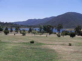
 Overlooking the Talbingo golf course towards Jounama Dam (December 2005) | |
| Coordinates | 35°34′0″S 148°18′0″E / 35.56667°S 148.30000°E |
| Population | 224 (2021 census)[1] |
| Postcode(s) | 2720 |
| Elevation | 410 m (1,345 ft) |
| Location | 454 km (282 mi) SW of Sydney |
| LGA(s) | Snowy Valleys Council |
| County | Wallace |
| State electorate(s) | Wagga Wagga |
| Federal division(s) | Eden-Monaro |
Talbingo is a small town in New South Wales, Australia at the edge of the Snowy Mountains on the Snowy Mountains Highway. The town is 410 metres above sea level. It is on the Tumut River, which has been inundated by Jounama Pondage.
Talbingo resident Jack Bridle, whose family were early European settlers of the area, suggests the name to be a corruption of the English word "tall" and the Aboriginal words "Binji", "Binge" or "Bingo" meaning belly. Mount Talbingo resembles the big belly of a man lying down.
