Tama County | |
|---|---|
 Tama County Courthouse in Toledo | |
 Location within the U.S. state of Iowa | |
 Iowa's location within the U.S. | |
| Coordinates: 42°04′43″N 92°31′53″W / 42.078611111111°N 92.531388888889°W | |
| Country | |
| State | |
| Founded | 1843 |
| Named for | Taimah |
| Seat | Toledo |
| Largest city | Tama |
| Area | |
• Total | 722 sq mi (1,870 km2) |
| • Land | 721 sq mi (1,870 km2) |
| • Water | 1.1 sq mi (3 km2) 0.1% |
| Population (2020) | |
• Total | 17,135 |
| • Density | 24/sq mi (9.2/km2) |
| Time zone | UTC−6 (Central) |
| • Summer (DST) | UTC−5 (CDT) |
| Congressional district | 1st |
| Website | www |

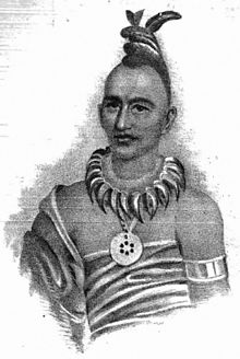
Tama County /ˈteɪmə/ is a county located in the U.S. state of Iowa. As of the 2020 census, the population was 17,135.[1] Its county seat is Toledo.[2] The county was formed on February 17, 1843[3] and named for Taimah, a leader of the Meskwaki people.[4]
- ^ "2020 Census State Redistricting Data". census.gov. United states Census Bureau. Retrieved August 12, 2021.
- ^ "Find a County". National Association of Counties. Retrieved June 7, 2011.
- ^ "City Community Description Congressional district Overview Population District type Geographical location/Climate Closest major city Political structure History Cultural institutions/events Distinguishing features Existing ties with Russia". ccfrussia.ru. Archived from the original on September 19, 2010. Retrieved April 11, 2018.
- ^ Tama County