Tanagura
棚倉町 | |
|---|---|
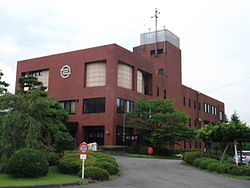
 Tanagura Town Hall | |
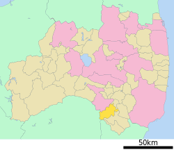
 Location of Tanagura in Fukushima Prefecture | |
| Coordinates: 37°01′47.5″N 140°22′46.5″E / 37.029861°N 140.379583°E | |
| Country | Japan |
| Region | Tōhoku |
| Prefecture | Fukushima |
| District | Higashishirakawa |
| Area | |
• Total | 159.93 km2 (61.75 sq mi) |
| Population (April 2020) | |
• Total | 13,827 |
| • Density | 86/km2 (220/sq mi) |
| Time zone | UTC+9 (Japan Standard Time) |
| - Tree | Japanese Red Pine |
| - Flower | Azalea |
| Phone number | 0247-33-3111 |
| Address | 33 Nakayano, Tanagura, Tanagura-machi, Higashishirakawa-gun, Fukushima-ken 963-6131 |
| Website | Official website |

Tanagura (棚倉町, Tanagura-machi) is a town located in Fukushima Prefecture, Japan. As of 1 April 2020[update], the town had an estimated population of 13,827 in 5053 households,[1] and a population density of 86 persons per km². The total area of the town was 159.93 km2 (61.75 sq mi).
- ^ Tanagura official statistics(in Japanese)


