Tanohata
田野畑村 | |
|---|---|
 Tanohata Village Hall | |
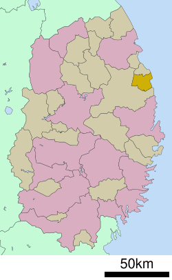
 Location of Tanohata in Iwate Prefecture | |
| Coordinates: 39°55′49.7″N 141°53′20.1″E / 39.930472°N 141.888917°E | |
| Country | Japan |
| Region | Tōhoku |
| Prefecture | Iwate |
| District | Shimohei |
| Area | |
| • Total | 156.19 km2 (60.31 sq mi) |
| Population (May 1, 2020) | |
| • Total | 3,244 |
| • Density | 21/km2 (54/sq mi) |
| Time zone | UTC+9 (Japan Standard Time) |
| City symbols | |
| • Tree | Kiri |
| • Flower | Rhododendron subg. Hymenanthes |
| • Bird | Copper pheasant |
| Phone number | 0194-34-2111 |
| Address | 143-1 Tanohata, Tanohata-mura, Shimohei-gun, Iwate-ken 028-8407 |
| Website | Official website |

Tanohata (田野畑村, Tanohata-mura) is a village located in Iwate Prefecture, Japan. As of 1 May 2020[update], the village had an estimated population of 3,244, and a population density of 21 persons per km² in 1,398 households.[1] The total area of the village is 156.19 square kilometres (60.31 sq mi).


