| Tantanoola South Australia | |||||||||||||||
|---|---|---|---|---|---|---|---|---|---|---|---|---|---|---|---|
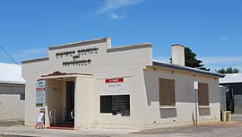
 Post office | |||||||||||||||
| Coordinates | 37°41′51″S 140°27′20″E / 37.697439°S 140.455519°E[1] | ||||||||||||||
| Population | 226 (UCL 2021)[2] | ||||||||||||||
| Established | 10 July 1879 (town) 23 February 1995 (locality)[3][4] | ||||||||||||||
| Postcode(s) | 5280[5] | ||||||||||||||
| Elevation | 25 m (82 ft) (Railway Station)[6] | ||||||||||||||
| Time zone | ACST (UTC+9:30) | ||||||||||||||
| • Summer (DST) | ACDT (UTC+10:30) | ||||||||||||||
| Location | |||||||||||||||
| LGA(s) | |||||||||||||||
| Region | Limestone Coast[7] | ||||||||||||||
| County | Grey[1] | ||||||||||||||
| State electorate(s) | MacKillop[8] | ||||||||||||||
| Federal division(s) | Barker[9] | ||||||||||||||
| |||||||||||||||
| |||||||||||||||
| Footnotes | Adjoining localities[1] | ||||||||||||||
Tantanoola is a town in regional South Australia. The name is derived from the aboriginal word tentunola, which means boxwood / brushwood hill or camp. Tantanoola was originally named 'Lucieton' by Governor Jervois after his daughter Lucy Caroline, on 10 July 1879. It was changed by Governor Robinson to 'Tantanoola' on 4 October 1888. At the 2006 census, Tantanoola had a population of 255.[11]
Tantanoola is in the Wattle Range Council local government area, the South Australian House of Assembly electoral districts of MacKillop and Mount Gambier, and the Australian House of Representatives Division of Barker.
The primary school closed in July 2020 after the farcical situation of having more staff than students. The remaining students transferred to nearby schools in Millicent and Mount Gambier.
- ^ a b c d e "Search results for 'Tantanoola, LOCB' with the following datasets being selected - 'Suburbs and Localities', 'Government Towns', 'Counties', 'Local Government Areas', 'SA Government Regions', 'Land Development Plan Zone Categories' and 'Gazetteer'". Location SA Map Viewer. Government of South Australia. Retrieved 25 November 2018.
- ^ Australian Bureau of Statistics (28 June 2022). "Tantanoola (urban centre and locality)". Australian Census 2021.
- ^ Morgan, William (10 July 1878). "Untitled proclamation re the Town of Lucieton" (PDF). The South Australian Government Gazette. Government of South Australia. p. 70. Retrieved 25 November 2018.
- ^ Kentish, P.M. (23 February 1995). "GEOGRAPHICAL NAMES ACT, 1991 Notice to Assign Boundaries to a Place" (PDF). The South Australian Government Gazette. South Australian Government. p. 678. Retrieved 15 May 2018.
- ^ a b c "Postcode for Tantanoola, South Australia". Postcodes Australia. Retrieved 21 February 2018.
- ^ "Search results for 'Tantanoola, LOCB' with the following datasets being selected - 'Suburbs and Localities', 'Gazetteer' and 'Railway'". Location SA Map Viewer. Government of South Australia. Retrieved 25 November 2018.
- ^ "Limestone Coast SA Government region" (PDF). The Government of South Australia. Retrieved 10 October 2014.
- ^ "District of MacKillop Background Profile". Electoral Commission SA. Retrieved 29 March 2016.
- ^ "Federal electoral division of Barker" (PDF). Australian Electoral Commission. Retrieved 28 March 2016.
- ^ a b c "Monthly climate statistics: Summary statistics Mount Gambier Aero (nearest weather station)". Commonwealth of Australia, Bureau of Meteorology. Retrieved 27 November 2018.
- ^ Australian Bureau of Statistics (25 October 2007). "Tantanoola (L) (Urban Centre/Locality)". 2006 Census QuickStats. Retrieved 29 October 2011.
