Taplejung
གཏཔ་ལེ་རྫོང (ताप्लेजोङ) | |
|---|---|
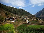
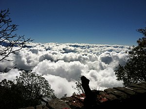
Dudh Kunda at Yamtari Glacier, Lelep village, view from Pathibhara temple, Gunsa village (clockwise from top) | |
| Nickname: ताप्लेजुङ जिल्ला (གཏཔ་ལེ་རྫོངརྫོང་ཁོངས།) | |
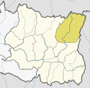
 Location of Taplejing (dark yellow) in Koshi Province | |
| Coordinates: 27°21′0″N 87°40′0″E / 27.35000°N 87.66667°E | |
| Country | Nepal |
| Province | Koshi Province |
| Established | 1962 |
| Admin HQ. | Phungling Municipality |
| Government | |
| • Type | Coordination committee |
| • Body | DCC, Taplejung |
| • Head | Mr. Ghanendra Maden |
| • Deputy-Head | Mrs. Debimaya Nepali |
| Area | |
| • Total | 3,646 km2 (1,408 sq mi) |
| • Rank | 3rd |
| Highest elevation | 8,586 m (28,169 ft) |
| Lowest elevation | 670 m (2,200 ft) |
| Population (2021)[1] | |
| • Total | 120,590 |
| • Density | 33/km2 (86/sq mi) |
| Time zone | UTC+05:45 (NPT) |
| Postal Codes | 57500 |
| Website | ddctaplejung |
Taplejung District (Nepali: ताप्लेजुङ जिल्ला ) is one[2] of 77 districts of Nepal and one of the 14 districts of Koshi Province. It is located deep in the Himalayas in Eastern Nepal with བོད to the north across the Himalayas. Taplejung is the third largest district (by area) of Nepal.
The district covers an area of 3,646 square kilometres (1,408 sq mi) and has a total population (2011 Nepal census) of 127,461. The district is surrounded by Tibet in the north, Sankhuwasabha District in the west, Tehrathum District and Panchthar District in the south and Sikkim (India) in the east. Geographically, the district is located at a latitude of 27º 06' to 27º 55'N and a longitude of 87º57' to 87º40' E.[3]
- ^ Household and population by districts, Central Bureau of Statistics (CBS) Nepal Archived 2013-07-31 at the Wayback Machine
- ^ "Taplejung District in Nepal". Retrieved 28 March 2020.
- ^ "Introduction DCC Taplejung". Retrieved 28 March 2020.


