| Tarawera Falls | |
|---|---|
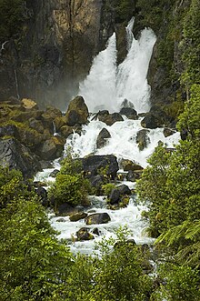
 Tarawera Falls at high flow | |
 | |
| Location | Bay of Plenty, New Zealand |
| Type | Plunge |
| Total height | 65m |
| Watercourse | Tarawera River |
| Average flow rate | 7 m3/s (250 cu ft/s) [1]: 491 |
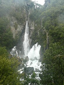
Tarawera Falls is a 65 m (213 ft) high waterfall on the Tarawera River in the Bay of Plenty region in New Zealand's North Island.
The Tarawera River flows out of Lake Tarawera and across a rhyolitic lava flow that erupted from Mt Tarawera about 14,000 years ago. The river disappears about 30 metres (98 feet) back from the clifftop into flooded caves in the lava and pours out halfway up the cliff on the far side of the flow.[2][3]
After rain, part of the flow passes over the top of the cliff as a 65 m (213 ft) tall companion fall.
Access is from the town of Kawerau and is a drive of about 45 minutes over unsealed roads, followed by a walk of about 20 minutes.[4] A forestry access permit is required, available from the Information Centre in Kawerau.[3]
- ^ Cite error: The named reference
Hodgkinson2005was invoked but never defined (see the help page). - ^ Information contained on "An Underground River" information panel at the end of the track.
- ^ a b "Tarawera Falls Track". Department of Conservation NZ. Retrieved 20 July 2020.
- ^ "Tarawera Falls". World of Waterfalls. Retrieved 30 August 2014.

