This article needs additional citations for verification. (May 2017) |
| Tase Dam | |
|---|---|
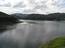
 Tase Dam, September 2007 | |
| Official name | 田瀬ダム |
| Location | Hanamaki, Iwate, Japan |
| Coordinates | 39°20′35″N 141°19′07″E / 39.34306°N 141.31861°E |
| Construction began | 1941 |
| Opening date | 1954 |
| Owner(s) | Ministry of Land, Infrastructure and Transport |
| Dam and spillways | |
| Type of dam | Gravity dam |
| Impounds | Sarugaishi River |
| Height | 81.5 m |
| Length | 320 m |
| Reservoir | |
| Creates | Lake Tase |
| Total capacity | 146,500,000 m3 |
| Catchment area | 740 km2. |
| Surface area | 600 hectares |
| Power Station | |
| Annual generation | 27,000 KW |

Tase Dam (田瀬ダム, Tase-damu) is a multipurpose dam located on the Sarugaishi River in the former town of Tōwa which is now a part of the city of Hanamaki in Iwate Prefecture, in the Tohoku region of northern Japan. Completed in 1954, it is managed by the Tohoku Regional Development Bureau of the Ministry of Land, Infrastructure and Transport. Located on the Sarugaishi River, a branch of the Kitakami River, it is the first of the dams completed as part of the Kitakami Area Comprehensive Development Plan (KVA). The dam creates Lake Tase (田瀬湖, Tase-ko), a popular sightseeing spot.
