Tatebayashi
館林市 | |
|---|---|
 Tatebayashi city hall | |
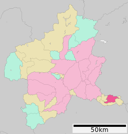
 Location of Tatebayashi in Gunma Prefecture | |
| Coordinates: 36°14′41.4″N 139°32′31.6″E / 36.244833°N 139.542111°E | |
| Country | Japan |
| Region | Kantō |
| Prefecture | Gunma |
| Government | |
| • Mayor | Tada Yoshihiro (since April 2021) |
| Area | |
• Total | 60.97 km2 (23.54 sq mi) |
| Population (February 2024) | |
• Total | 74,027 |
| • Density | 1,200/km2 (3,100/sq mi) |
| Time zone | UTC+9 (Japan Standard Time) |
| Phone number | 0276-72-4111 |
| Address | 1-1 Shiromachi, Tatebayashi-shi, Gunma-ken 374-8501 |
| Climate | Cfa |
| Website | Official website |
| Symbols | |
| Bird | Anas poecilorhyncha |
| Flower | Rhododendron obtusum |
| Tree | Pinus thunbergii |

Tatebayashi (館林市, Tatebayashi-shi) is a city located in Gunma Prefecture, Japan. As of 1 February 2024[update], the city had an estimated population of 74,027 in 34,486 households,[1] and a population density of 1200 people per km². The total area of the city is 60.97 square kilometres (23.54 sq mi). Tatebayashi is famous for Azalea Hill Park and Bunbuku Chagama of Morin-ji temple.
- ^ "Tatebayashi City official statistics" (in Japanese). Japan.


