Te Anau | |
|---|---|
 | |
 | |
| Coordinates: 45°25′S 167°43′E / 45.417°S 167.717°E | |
| Country | New Zealand |
| Island | South Island |
| Region | Southland region |
| Territorial authorities of New Zealand | Southland District |
| Ward | Mararoa Waimea Ward |
| Community | Fiordland Community |
| Electorates |
|
| Government | |
| • Territorial authority | Southland District Council |
| • Regional council | Southland Regional Council |
| • Mayor of Southland | Rob Scott |
| • Southland MP | Joseph Mooney |
| • Te Tai Tonga MP | Tākuta Ferris |
| Area | |
| • Total | 6.64 km2 (2.56 sq mi) |
| Population (June 2023)[2] | |
| • Total | 3,060 |
| • Density | 460/km2 (1,200/sq mi) |
| Postcode(s) | 9600 |
| Area code | 03 |
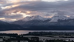
Te Anau is a town in the Southland region of the South Island of New Zealand. In Māori, Te-Anau means the Place of the Swirling Waters.[3] It is on the eastern shore of Lake Te Anau in Fiordland. Te Anau is 155 kilometres north of Invercargill and 171 kilometres to the southwest of Queenstown (via state highway 6). Manapouri lies 21 kilometres to the south. Te Anau lies at the southern end of the Milford Road, (State Highway 94) 117 kilometres to the south of Milford Sound.
- ^ Cite error: The named reference
Areawas invoked but never defined (see the help page). - ^ "Subnational population estimates (RC, SA2), by age and sex, at 30 June 1996-2023 (2023 boundaries)". Statistics New Zealand. Retrieved 25 October 2023. (regional councils); "Subnational population estimates (TA, SA2), by age and sex, at 30 June 1996-2023 (2023 boundaries)". Statistics New Zealand. Retrieved 25 October 2023. (territorial authorities); "Subnational population estimates (urban rural), by age and sex, at 30 June 1996-2023 (2023 boundaries)". Statistics New Zealand. Retrieved 25 October 2023. (urban areas)
- ^ "Community History - Te Anau and Manapouri". www.teanau.net.nz. Retrieved 4 April 2021.