Tehran Province
Persian: استان تهران | |
|---|---|
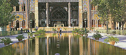
 Tehran has been Iran's capital since 1778 | |
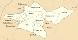
 Counties of Tehran province | |
 Location of Tehran province within Iran | |
| Coordinates: 35°32′N 51°31′E / 35.533°N 51.517°E[2] | |
| Country | Iran |
| Region | Region 1[1] |
| Capital | Tehran |
| Counties | 16 |
| Government | |
| • Governor-general | Mohammad-Sadegh Motamedian |
| Area | |
| • Total | 18,814 km2 (7,264 sq mi) |
| Population (2016)[4] | |
| • Total | 13,267,637 |
| • Estimate (2020) | 13,973,000[3] |
| • Density | 710/km2 (1,800/sq mi) |
| Time zone | UTC+03:30 (IRST) |
| ISO 3166 code | IR-23 |
| Main language(s) | Persian |
| HDI (2018) | 0.834[5] very high · 1st |
Tehran province (Persian: استان تهران)[a] is one of the 31 provinces of Iran. Its capital is the city of Tehran.[6]
Tehran province covers an area of 18,814 square kilometres (7,264 sq mi) and is located to the north of the central plateau of Iran. It was made a part of the First Region with its secretariat located in Tehran, upon the division of the provinces into 5 regions, solely for coordination and development purposes on June 22, 2014.[1]
The province of Tehran has over 12 million inhabitants and is Iran's most densely populated region. Approximately 86.5 percent reside in urban areas and 13.5 percent in rural areas of the province.[7]
- ^ a b همشهری آنلاین-استانهای کشور به ۵ منطقه تقسیم شدند
- ^ OpenStreetMap contributors (24 May 2024). "Tehran Province" (Map). OpenStreetMap (in Persian). Retrieved 24 May 2024.
- ^ "توجه: تفاوت در سرجمع به دليل گرد شدن ارقام به رقم هزار مي باشد. (in Persian)". Retrieved 29 September 2020.
- ^ Cite error: The named reference
2016 Tehran Provincewas invoked but never defined (see the help page). - ^ "Sub-national HDI - Area Database - Global Data Lab". hdi.globaldatalab.org. Retrieved 13 September 2018.
- ^ Habibi, Hassan (10 December 2014) [Approved 21 June 1369]. Approval of the organization and chain of citizenship of the elements and units of the national divisions of Tehran province centered on the city of Tehran. rc.majlis.ir (Report) (in Persian). Ministry of the Interior, Defense Political Commission of the Government Board. Notification 8416/T133K. Archived from the original on 30 November 2014. Retrieved 16 December 2023 – via Islamic Parliament Research Center.
- ^ www.sci.org.ir/content/userfiles/_sci_en/sci_en/sel/j-shvro-84.html. Retrieved November 2011 Archived 2021-02-22 at the Wayback Machine
Cite error: There are <ref group=lower-alpha> tags or {{efn}} templates on this page, but the references will not show without a {{reflist|group=lower-alpha}} template or {{notelist}} template (see the help page).