Telegraph Hill | |
|---|---|
 Telegraph Hill from San Francisco Bay | |
| Coordinates: 37°48′09″N 122°24′21″W / 37.802409°N 122.40587°W | |
| Country | |
| State | |
| City-county | San Francisco |
| Government | |
| • Supervisor | Aaron Peskin |
| • State Assembly | Matt Haney (D)[1] |
| • State Senator | Scott Wiener (D)[1] |
| • U. S. Rep. | Nancy Pelosi (D)[2] |
| Area | |
| • Total | 0.215 sq mi (0.56 km2) |
| • Land | 0.215 sq mi (0.56 km2) |
| Population (2008)[3] | |
| • Total | 8,177 |
| • Density | 38,055/sq mi (14,693/km2) |
| ZIP Code | 94133, 94111 |
| Area codes | 415/628 |
| Reference no. | 91[4] |
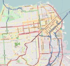
Telegraph Hill (elev. 285 ft (87 m)) is a hill and surrounding neighborhood in San Francisco, California.[5] It is one of San Francisco's 44 hills, and one of its original "Seven Hills".
- ^ a b "Statewide Database". UC Regents. Retrieved May 19, 2018.
- ^ "California's 11th Congressional District - Representatives & District Map". Civic Impulse, LLC.
- ^ a b "Telegraph Hill neighborhood in San Francisco, California (CA), 94133 detailed profile".
- ^ Cite error: The named reference
CHLwas invoked but never defined (see the help page). - ^ Height Limits in Northeastern San Francisco. San Francisco (Calif.) Department of City Planning. 1963. p. 7. Retrieved 24 December 2019.
The map on pages 12 & 13 shows this land mass, dominated by three hills ranging in height from 350 feet at the southwest corner of Pacific Heights to the 285 foot elevation of Telegraph Hill
