Temindung Airport Bandara Temindung | |||||||||||
|---|---|---|---|---|---|---|---|---|---|---|---|
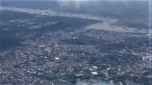
 Temindung Airport in 2021, 3 years after its closure | |||||||||||
| Summary | |||||||||||
| Airport type | Defunct | ||||||||||
| Operator | Civil Aviation Department | ||||||||||
| Serves | Samarinda | ||||||||||
| Location | Sungai Pinang, Samarinda | ||||||||||
| Opened | 1974 | ||||||||||
| Closed | 24 May 2018 | ||||||||||
| Elevation AMSL | 10 m / 33 ft | ||||||||||
| Coordinates | 0°28′53″S 117°9′21″E / 0.48139°S 117.15583°E | ||||||||||
| Map | |||||||||||
Location in Samarinda Location in Kalimantan | |||||||||||
 | |||||||||||
| Runways | |||||||||||
| |||||||||||
Temindung Airport (IATA: SRI, ICAO: WALS) was the airport of Samarinda from 1974 until 2018. It was officially known as Samarinda Airport, it was closed and replaced by the new APT Pranoto International Airport at Sungai Siring, 30 kilometres (19 mi) to the north. It is often known as Samarinda Airport, Temindung Airport, or simply Temindung, to distinguish it from its successor which is often referred to as Sungai Siring Airport.
The airport was home to Samarinda's carrier Kaltim Airlines. Temindung is located on the north side of Karangmumus River in Sungai Pinang, Samarinda. There is only one runway in use, numbered 04/22 and oriented northeast–southwest (34/214 degrees true, 32/212 degrees magnetic). Near the southern end of the runway, a building rose up to nine stories.[1]


