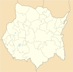
Temixco | |
|---|---|
City and Municipality | |
 Mirador municipal Cerro de las 3 cruces | |
| Coordinates: 18°51′N 99°14′W / 18.850°N 99.233°W | |
| Country | Mexico |
| State | Morelos |
| Municipal Status | March 5, 1933[1] |
| City | March 7, 1990[1] |
| Government | |
| • Type | Council-manager |
| • Municipal President | Jazmín Solano[2] |
| Area | |
| • Total | 102.89 km2 (39.73 sq mi) |
| Population | |
| • Total | 116,143 |
| • Density | 1,100/km2 (2,900/sq mi) |
| Time zone | UTC−6 (CST) |
| • Summer (DST) | UTC−5 (CDT) |
| Postal Code | 62580 (Temixco Center)[4] |
| Area code | 777[2] |
| Website | Official site (in Spanish) |
Temixco is the fourth-largest city in the Mexican state of Morelos. It stands at 18°51′N 99°14′W / 18.850°N 99.233°W in the west-northwest part of the state.
The city serves as the municipal seat for the surrounding municipality, with which it shares a name. The municipality reported 116,143 inhabitants in 2010, a growth rate of 1.5% for each of the previous ten years.[5] The municipality has an area of 87.869 km2 (33.926 sq mi).
Temixco is 6 kilometres (3.7 mi) from Cuernavaca and 85 kilometres (53 mi) from Mexico City.[6]
- ^ a b c "Morelos - Temixco". www.inafed.gob.mx. Retrieved May 17, 2020.
- ^ a b "AYUNTAMIENTO DE TEMIXCO – temixco.gob.mx" (in Mexican Spanish). Retrieved May 17, 2020.
- ^ "Número de habitantes. Morelos". cuentame.inegi.org.mx. Retrieved May 17, 2020.
- ^ "Listado de todos los Códigos Postales de Temixco, Morelos". micodigopostal.org. Retrieved May 17, 2020.
- ^ "Mexico: Administrative Division (States and Municipalites) - Population Statistics, Charts and Map".
- ^ García, Jerry. Looking Like the Enemy: Japanese Mexicans, the Mexican State, and US Hegemony, 1897-1945. University of Arizona Press, February 27, 2014. ISBN 081659886X, 9780816598861. p. 174.

