| Temperance River State Park | |
|---|---|
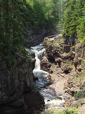
 One of the park's waterfalls | |
| Location | Cook, Minnesota, United States |
| Coordinates | 47°33′15″N 90°52′20″W / 47.55417°N 90.87222°W |
| Area | 5,059 acres (20.47 km2) |
| Elevation | 663 ft (202 m)[1] |
| Established | 1957 |
| Governing body | Minnesota Department of Natural Resources |
Temperance River State Park is a state park of Minnesota, USA, located between the communities of Schroeder and Tofte on Highway 61 on the North Shore of Lake Superior. It has campsites, picnic areas, and hiking trails on both sides of the Temperance River.
- ^ "Temperance River State Park". Geographic Names Information System. United States Geological Survey. May 1, 1991. Retrieved February 25, 2011.

