Teteven Municipality
Община Тетевен | |
|---|---|
Municipality | |
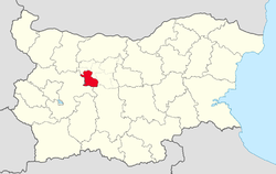
 Teteven Municipality within Bulgaria and Lovech Province. | |
| Coordinates: 42°52′N 24°17′E / 42.867°N 24.283°E | |
| Country | |
| Province (Oblast) | Lovech |
| Admin. centre (Obshtinski tsentar) | Teteven |
| Area | |
| • Total | 697 km2 (269 sq mi) |
| Population (December 2009)[1] | |
| • Total | 22,016 |
| • Density | 32/km2 (82/sq mi) |
| Time zone | UTC+2 (EET) |
| • Summer (DST) | UTC+3 (EEST) |
Teteven Municipality (Bulgarian: Община Тетевен) is a municipality (obshtina) in Lovech Province, Central-North Bulgaria, located from the northern slopes of the central Stara planina mountain to the area of the Fore-Balkan. It is named after its administrative centre - the town of Teteven.
The municipality embraces a territory of 697 km2 (269 sq mi) with a population of 22,016 inhabitants, as of December 2009.[1]
The main road E772 crosses the area through the northernmost parts of the municipality.