This article needs additional citations for verification. (January 2021) |
Tha Ruea
ท่าเรือ | |
|---|---|
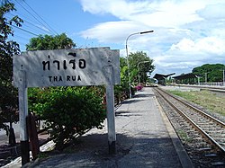
 Sign of Tha Ruea railway station (spelled Tha Rua) | |
 District location in Phra Nakhon Si Ayutthaya province | |
| Coordinates: 14°33′6″N 100°43′39″E / 14.55167°N 100.72750°E | |
| Country | Thailand |
| Province | Ayutthaya |
| Seat | Tha Chao Sanook |
| Tambon | 10 |
| Muban | 84 |
| Area | |
| • Total | 106.2 km2 (41.0 sq mi) |
| Population (2018) | |
| • Total | 46,925[1] |
| • Density | 441.9/km2 (1,145/sq mi) |
| Time zone | UTC+7 (ICT) |
| Postal code | 13130 |
| Geocode | 1402 |
Tha Ruea (Thai: ท่าเรือ, pronounced [tʰâː rɯ̄a̯]) is a district (amphoe) in northeastern part of Phra Nakhon Si Ayutthaya province, central Thailand.
- ^ "ร่ยงานสถิติจำนวนประชากรและบ้านประจำปี พ.ศ.2561" [Statistics, population and house statistics for the year 2018]. Registration Office Department of the Interior, Ministry of the Interior. stat.bora.dopa.go.th (in Thai). 31 December 2018. Retrieved 20 June 2019.