Thandiani | |
|---|---|
 Thandiani, Galyat | |
| Coordinates: 34°14′N 73°21′E / 34.233°N 73.350°E | |
| Country | |
| Province | Khyber-Pakhtunkhwa |
| District | Abbottabad District |
| Time zone | UTC+5 (PST) |
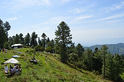
Thandiani (literally meaning "very cold") is a hill station in the Galyat area of the Khyber Pakhtunkhwa Province of Pakistan. Thandiani is located in the northeast of Abbottabad District and is about 37.5 kilometres (23.3 mi) from Abbottabad in the foothills of the Himalayas.[1][2] To the east beyond the Kunhar River lies the snow-covered Pir Panjal mountain range of Kashmir. Visible to the north and northeast are the mountains of Kohistan and Kaghan. To the northwest are the snowy ranges of Swat and Chitral. The hills of Thandiani are about 2,750 metres (9,020 ft) above sea level.
- ^ "Thandiani - Hill Station in Galyat". Thenews.com.pk. Retrieved 19 June 2018.
- ^ "Distance from Abbottabad". Google Maps. Retrieved 19 June 2018.

