This article has multiple issues. Please help improve it or discuss these issues on the talk page. (Learn how and when to remove these messages)
|
Tharparkar District
Eastern Sindh Frontier District | |
|---|---|
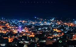
Clockwise from top-left: Naukot Fort, Jain Temple, Nagarparkar, Thar Desert, view of Mithi, Bhodesar Masjid | |
 Location in Sindh | |
| Coordinates: 24°44′24″N 69°48′0″E / 24.74000°N 69.80000°E | |
| Country | |
| Province | |
| Division | Mirpur Khas |
| Established | 1860[1] |
| Founded by | British India Government |
| Headquarters | Mithi |
| Government | |
| • Type | District Administration |
| • Deputy Commissioner | Muhammad Nawaz Sohoo, PAS[2] |
| • District Police Officer | Zahida Parveen Jamro, PSP |
| • District Health Officer | Dr. Herchand Rai |
| Area | |
| • District of Sindh | 19,637 km2 (7,582 sq mi) |
| Population | |
| • District of Sindh | 1,778,407 |
| • Density | 91/km2 (230/sq mi) |
| • Urban | 144,405 (8.12%) |
| • Rural | 1,634,002 |
| Demonym | Thari |
| Time zone | UTC+5 (PKT) |
| HDI (2018)[5] Rank in Pakistan | |
| Constituencies
Provincial PS-54 Tharparkar-I - Abdul Razzaque PS-55 Tharparkar-II - Muhammad Qasim Soomro PS-56 Tharparkar-III - Faqir Sher Muhammad Bilalani PS-57 Tharparkar-IV - Arbab Lutfullah National NA-221 Tharparkar-I - Pir Noor Muhammad Shah Jeelani NA-222 Tharparkar-II - Mahesh Kumar Malani | |
Tharparkar (Dhatki/Sindhi: ٿرپارڪر; Urdu: تھرپارکر, Urdu pronunciation: [t̪ʰəɾpɑːɾkəɾ]), also known as Thar, is a district in Sindh province in Pakistan, headquartered at Mithi. Before Indian independence it was known as the Thar and Parkar (1901–1947) or Eastern Sindh Frontier District (1860–1901).[1]
The district is the largest in Sindh,[6] and has the largest Hindu population in Pakistan.[7] It has the lowest Human Development Index rating of all the districts in Sindh. Currently the Sindh government is planning to divide the Tharparkar district into Tharparkar and Chhachro district.[8]
- ^ a b Encyclopaedia Britannica : a dictionary of arts, sciences, and general literature. Philadelphia: Hubbard. 1889.
- ^ "Tharis warned against violating cultivation ban". Dawn. 23 June 2019.
- ^ Cite error: The named reference
2023censuswas invoked but never defined (see the help page). - ^ Cite error: The named reference
2017censuswas invoked but never defined (see the help page). - ^ "PakistanHuman Development Index Report" (PDF). United Nations Development Programme. 2 May 2018. Archived from the original (PDF) on 28 April 2021. Retrieved 30 July 2019.
- ^ "Population - Pakistan Bureau of Statistics" (PDF). www.pbscensus.gov.pk/.
- ^ "Population of Hindus in the Pakistan". Pakistan Hindu Council. 13 January 2017. Archived from the original on 18 July 2019.
- ^ "Sindh govt to divide Tharparkar in two districts". Retrieved 7 June 2021.


